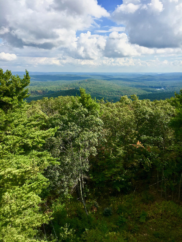
Fifty shades of green burst forth before my eyes as I emerge on the top of the 68-foot (21-meter) fire tower capping Mt. Grace. My metal aerie affords me sweeping views of the vast, remote countryside, which today is bathed in bright emerald, lime and mossy hues. A sea of marshmallow clouds forms the perfect backdrop to this palette of greenery, making me loathe to descend into the dull, dun-colored forest below. But I must. Some six miles (10 km) west lies the Stratton Mountain summit, where I’m told unparalleled views of neighboring Mt. Ascutney, Mt. Monadnock and Mt. Watchusett await.
Navigating Mt. Grace
Want to check out this prime parcel of real estate? You can complete this hike in one day. But if you’d like to take your time, enjoy the sights and camp out, try this sample itinerary.
From MA 78
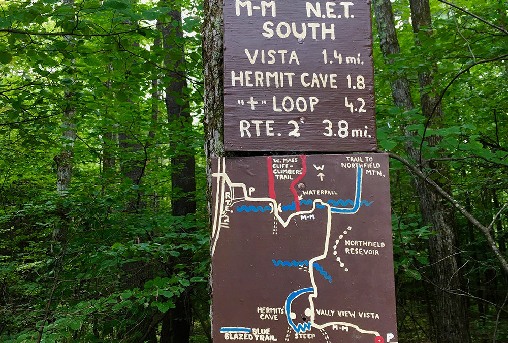
1. Follow the trail to the 1,621-foot (494-meter) summit of Mt. Grace, the highest peak on the New England Trail. (1.5 mi / 2.4 km)
2. Descend via the Old Snowshoe Trail through hardwood and red spruce to the southern tip of Mt. Grace
State Forest. (2.7 mi / 4.4 km)
3. Turn right onto Northfield Road, once part of the historic 5th Massachusetts Turnpike. The old ‘pike leaves
the road and heads left back into the woods and up a remote stretch of trail.
4. When you reach the Alexander Hill parking area (mile 7.1 / km 11.4), it’s just under a mile to the Richardson-Zlogar
cabin.
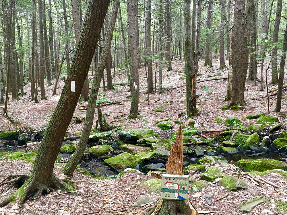
5. From the cabin, the trail tumbles downhill to the lowlands near Great Swamp, an early settlement site
and headwaters for Keyup Brook.
6. Climb 1 mile (1.6 km) through a hardwood-and-hemlock forest to the trailhead on Gulf Road.
Camping Options
Most of the New England Trail, which encompasses this itinerary, has limited camping spots. But two of its few campsites are right here in Mt. Grace State Forest. Try one or both!
Campsite 1
Mount Grace (mile .3 / km .5)
A newer, 10′ x 13′ (3.5 m x 4 m) shelter anchors this spacious camp, which features a fire ring and two grills. The wooded site is steps off the trail; get water from Mountain Brook, just past the trailhead. Rest here to save strength for the rest of
the climb up to Mt. Grace – the grade averages 10.9 percent. First-come, first-served.
Campsite 2
Stratton Mountain (mile 8.0 / km 12.9)
Perched on the 1,285-foot (392-meter) summit of Stratton Mountain, this luxe campsite boasts two tent platforms, a porta-potty and cabin. Reservations required for the cabin; $3/person/night suggested donation. Sunrise is spectacular from this east-facing campsite.
Don’t Miss
There are many cool sights and side trips to take in. But here are two you should not miss.
Historic Turnpike
The 5th Massachusetts Turnpike, authorized in 1799, was one of 60+ stagecoach toll roads that operated in Massachusetts during the early 1800s. The route connected Leominster, Athol, Greenfield and Northfield. The NET travels along a portion of the old turnpike.
Stratton Mountain
En route to the Richardson-Zlogar cabin, check out the enormous granite sundial and giant-sized table at “West View,” the locals’ name for the west-facing bluff. Then add a stone to the massive cairn created atop a boulder.
If You Go
Ready to pack your bags? Here are some basic bits of info to know before you go.
TRAILHEAD: MA 78 north of Warwick
SEASON: Year-round
PERMIT: None required
CONTACT: newenglandtrail.org
DISTANCE: 10.2 miles (16.4 km)
TIME: Plan 2 days
Written for Backpacker magazine, September 2018


