The trek to Sapillo Creek was a day from hell. Sorry to say that, but it’s true. This was day two of our hike along the much-acclaimed Gila River Alternate, said to be stunning. Yesterday, as you read, the trail was anything but. So we thought today was the day for the beauty and amazing-ness. NOT.
We began hiking before 8 a.m. It was actually quite chilly for the first hour. The FarOut app noted that shortly after Bear Creek, the trail takes a turn or two that aren’t well marked. That was true, but thanks to the warning – and paying close attention to the app – we found the path. One person said that from here on out, the trail was wonderful.
Striking Out for Sapillo Creek
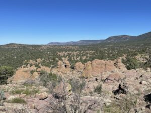
Initially, the trail was pretty nice. It took us through some woods, then up on these rocky formations. Cairns helped mark the way when it wasn’t obvious. But then the trail unspooled into some dry ravine. And here, the nightmare began.
As an alternate route, the path isn’t marked like the official CDT. 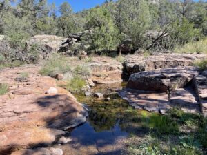 Still, the Mt. Taylor Alternate, for example, was mostly easy to follow. This was awful. First, the GPS arrow on the FarOut app kept telling us we were to the right of the path, then to the left, then to the right, etc. I’m guessing it was due to being in a ravine, and the app not getting a great signal as to where we were.
Next, there were lots of downed trees and damage from a 2020 fire, I believe. So there was no discernable trail. We were lost for such a long time. At one point, a deer was leaping through the ravine and got caught in some branches. It fell over and was flailing and we felt terrible. But there was nothing we could do to help.
The Day Drags On
Eventually, we found the path, although it was quite overgrown and we had to bushwhack a lot. It then pitched steeply uphill for miles, it seemed. We were moving so slowly. Our goal had been to reach Sapillo Creek, an easy 17-mile (99-km) hike. But we were so far behind.
We reached the apex of the climb, and from there the path was supposed to be a delightful downhill to Sapillo Creek. WRONG. The path was mostly downhill, yes, although there was one quite nasty climb. But mostly the path was super rocky. Couple a rocky trail with going downhill and you just can’t move fast.
We decided we couldn’t make Sapillo Creek after all. Except there was no place to pitch a tent as we kept descending on the rocky trail, so we had no choice but to kill ourselves hiking as fast as we could.
We did end up reaching the creek as the sun was almost down. It was quite stressful. We pitched our tent at the first spot that was reasonably level and not too filled with rocks and other crap. Then we hastily ate, cleaned up and went to bed.
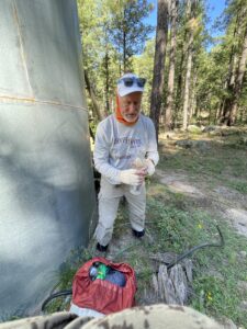
Ed is being a trooper about it, but I feel so badly. I thought he’d be joining me for a glorious stretch of trail, and so far it’s been a pretty nasty experience.
Snowshoe
Today’s Miles: 17.1 (27.5 km)
CDT Miles to Date: 251.3 (404.4 km)
CDT Miles to Go: 2,848.7 (4,584.5 km)


