
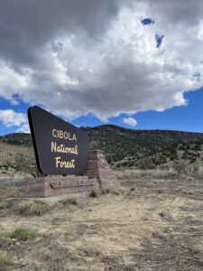
A year after being forced off the Continental Divide due to a torn meniscus (which needed surgery), I’m back on the trail. This time I’m starting around Mt. Taylor north of Grants, N.M. I left off last year in the south in Silver City, so why am I resuming my hike in northern New Mexico? Two reasons.
First, while I definitely prefer a sequential hike, last year southern New Mexico was unseasonably hot. Temps were in the 90s F (32-35 C) and, being in the desert, water was very scarce. Starting in northern New Mexico and hiking north should net me more favorable temperatures in mid-September. Second, it was almost impossible to get from Silver City to the El Paso or Albuquerque airports and vice versa. Grants, in contrast, is served by both an express shuttle and a bus.
Disclosure: This post contains affiliate links (among regular links) to products I own and like, or which I think you might like. This means that, at no extra cost to you, I will earn a commission if you click through and make a purchase.
Tweaking Plans to Start at Mt. Taylor
My original plan was to start in Grants and hike northbound to Cuba. Then my husband, Ed, would fly in and pick me up from Cuba, shuttling me back to Silver City. I’d then hike back to Grants. Silver City 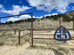 should be cooler toward the end of September, plus I’ll once again have easy passage to the airport from Grants. (There are so many logistics like this to consider when undertaking a long-distance hike!)
But now there’s another small tweak. The trail angels who are dropping water for me around Grants offered to take me to the Mt. Taylor Trailhead the day I arrived (today). I’d have enough time to hike the 6.4 miles (10.3 km) back to Grants, they said, which is all downhill when you’re heading southbound. Then the next day, they’d take me back to the trailhead so I could continue north to Cuba and resume my plan. Sounded good to me!
Heading Back to Grants
Must give a shout-out to the other trail angels who picked me up at the Albuquerque airport and drove me to Grants. Their daughter is hiking the CDT and has enjoyed help from other trail angels, so they wanted to pay it forward. I will do so, too. With all the nastiness in the world today, hiking reminds you that there are so many kind, generous people. But I digress.
 After checking in at my motel, the trail angels shuttled me uphill to the Mt. Taylor trailhead and I enjoyed an easy, downhill stroll back to Grants. More importantly, these two long-time hikers gave me great trail intel. I’d already noticed there are innumerable “alternate trails” listed in the CDT maps/apps. I was determined to hike the official CDT.
Well, it turns out the CDT is continuously morphing. What’s listed as “official” CDT today is not the same path as in the past. Oftentimes the “real” trail takes you on a poor route – on forest roads versus trail, on routes with little to no water (but scenic) to trails with reliable water, etc. I’m now amending my itinerary in real time, which I’ve almost never done. So who knows how this hike will go!
But, I suppose, that’s part of the fun.
Snowshoe
Today’s Miles: 6.4 (10.3 km)
CDT Miles to Date: 119.2 (191.8 km)
CDT Miles to Go: 2,980.8 (4,797.1 km)


