Today was supposed to be a fun day, finishing the last 12 miles (19.3 km) of the Highland Rim section of the trail, then heading north on the parkway to the Leiper’s Gap area. But it was not a fun day at all.
Last night, Amy and I camped at the Gordon House pullout. There was a nice bathroom there, plus plenty of flat spaces to camp. It was nice, other than that the bathroom had a light that kept shining in our faces all night. Oh, well.
The forecast called for a cloudy, warm day. Not perfect, but fine. We broke camp and started driving to our first car drop when the heavens opened up and it began to pour.
Heading to Highland Rim
Despite having just checked our weather app, things had quickly changed. Now it called for storms from 8-11 a.m., plus another storm cell possibly around 2 or 3. We dropped one car at the Highway 7/Fly area, then dropped another at Garrison Creek. According to our maps, this was a 12-mile (19.3-km) hike. Wrong!
 It was 12 miles (19.3 km) on the parkway, but 14.8 miles (23.8 km ) by trail, according to one sign (but contradicted by another). In the end, this is how our day went: We hiked in heavy rain or an hour or two. After that, we had rain on and off all day.
What Did We See?
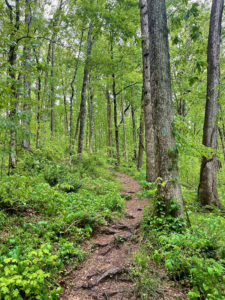
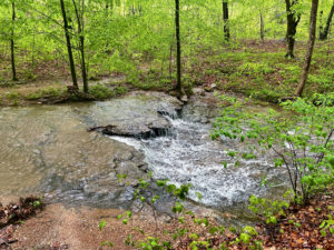
The Highland Rim trails were muddy and sloppy and gloppy. It appears it’s more an equestrian trail than a hiking trail, so we had to sidestep a ton of waterlogged horse apples. The trail crossed Burns Branch several times. Normally, this creek is probably very easy to cross without getting wet. Today, our feet got soaked.
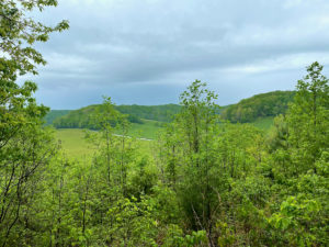
But despite our misery, the scenery was beautiful. We saw this cool turtle, which looked like it had petroglyphs painted in gold on its shell. The greenery came alive in the rain, turning a brilliant lime green. There were waterfalls galore. And yet …
 So Tired
It was 4:30 when we finished this section. We were supposed to have hiked another 8 miles (12.9 km) today, but that was not in the cards. Amy was done, and I did 5 miles (8.1 km) out and back from Garrison Creek to nudge myself toward my goal. We’re camping at Garrison Creek, which has a clean bathroom.
Tomorrow should be my triumphant finish. Rain was initially predicted starting at 10 a.m., so we figured we’d start early to do the last 12 miles (19.3 km). But now they’re saying the rain will start at 7 a.m. Rats! Not sure what we’ll do.
Disclosure: This post contains affiliate links (among regular links) to products I own and like, or which I think you might like. This means that, at no extra cost to you, I will earn a commission if you click through and make a purchase.
Snowshoe
Natchez Trace Miles Today: 19.8 (31.9 km)
NT Miles Overall: 438.2 (705.2 km)
NT Miles To Go: 5.8 (9.3 km)
A good book on the Natchez Trace is Nashville to New Orleans Road Trip, a Moon guide by Meg Littman that includes info on the Trace.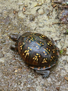
I really love my Vivobarefoot water shoes, which double as camp shoes. Get yours here!


