It’s Memorial Day weekend of 2020, when the coronavirus is wreaking havoc on the earth. Our state’s stay-at-home order is expiring, so what better time to knock off a few more miles along the North Country Trail?
My NCT section-hike goal for 2020 was to finish the NCT in Wisconsin, plus pick off some miles in either Minnesota or Michigan. With COVID-19 still raging, I wanted to stick close to home. So my plan morphed into finishing the Wisconsin miles and then the bulk of my remaining miles in Michigan’s Upper Peninsula.
Anyway, the Memorial Day weekend was just enough time to hike to the Minnesota border from the spot in northwestern Wisconsin where Ed and I left off last August, which was a connecting road route northwest of Gordon Dam. So that’s where we began.
Hiking During the Coronavirus
Right now, state park campsites are still closed due to the coronavirus, so no camping at Pattison State Park, the logical choice. Luckily, here in Douglas County you can camp anywhere in the county forest, which happens to be the largest county forest in Wisconsin.
The problem is, you have purchase a permit ahead of time and list the exact spot where you’ll be camping. But how do we know where we’ll be camping? We know the approximate mileage we’ll hike each day, but we have no way of knowing what the forest terrain is like until we get there. We could pick a spot that ends up swampy or full of scruffy underbrush. Enter Cathy.
A lovely woman named Cathy with the Douglas County Forestry Department consulted with some foresters before our arrival who said we should camp at the end of a snowmobile trail off of Milchesky Road. Great. So we paid the money and got the permit, then began to hike. It was about 1:45 p.m.
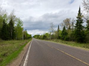
The weather today was gray and cloudy, which was fine. For a while it got kind of hot and buggy (mosquitoes and gnats), but near the end of the day it got much cooler. Yes!
I’d planned to hike 15.8 miles (25.4 km) of connecting road routes to Hwy. 35 this afternoon. Then we’d have to backtrack 1.8 miles (3 km) to our camping spot. But Ed was shuttling me, so he could drive me back from Hwy. 35.
Finding Our Campsite
Ed parked our car at the spot on Milchesky Road where the forester said we should camp, then walked back toward me. He said it didn’t look good. He was right! The spot was horrible! The ground was lumpy and bumpy and sort of marshy. We walked in about a quarter-mile (.4 km) in case the terrain flattened out and got drier, but it didn’t. It was all ankle-high grass, and there were ticks everywhere. No way were we going to camp here!
Luckily, I’d spotted a nice, flat, grass-less pull-off very close to this nasty spot. So we set up camp here. While this spot was largely good, there were still ticks here. Or maybe we brought them with us from exploring the previous spot. I’m not sure. But we probably pulled a dozen off of us. YUCK.
We did enjoy a nice dinner and are now ensconced in my beloved Big Agnes tent. Life is feeling a little more normal with this hike.
Oh, we also brought along two Thermacell devices to ward off the bugs at the campsite. They’re working really well!
Snowshoe and Stubs
WI NCT miles today: 15
WI NCT miles to date: 187.2
Total NCT miles to date: 903.1
Total NCT miles to go: 3,696.9
As am Amazon Associate, I may earn a small commission from qualifying purchases. This doesn’t affect the price you pay.
