Today’s trek to Spring Valley was OK. The day began quite chilly, and my tent was slick with dew. I wasn’t too worried, though, as today’s forecast was for lots of sun and temps around 70 F (21.1 C).
I met Tim for our final shuttle at Walton Park in Spring Valley. I’d booked two nights’ camping in the town’s Constitution Park for tonight and tomorrow (near Walton Park), but I was worried because storms are supposed to move in overnight. Well, Walton Park features a huge pavilion, which would make the perfect spot to pitch a tent when rain is in the forecast. Fortuitously, a sheriff’s deputy was in his car in the parking lot, so I asked if it was OK to camp here tonight, and he said yes. Yay!
Heading to Spring Valley
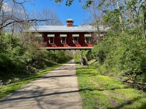
Back in Yellow Springs, I headed out on the asphalt bike path toward Spring Valley, which hosts the NCT and Buckeye Trail. The path was basically flat, crossing numerous creeks and passing through several towns, namely Xenia. It was a pleasant hike, although rather monotonous.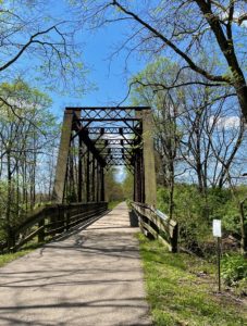
One major issue that emerged today is that Tim realized the Buckeye Trail app route doesn’t match the NCT route depicted on its website from Spring Valley to around Oregonia. In this area, the Buckeye Trail leaves the bike path for a dozen or more miles, following Caesar Creek. I’d seen some hikers note that horses had obliterated the trail in many portions, leaving it quite difficult to hike. Toss in some rain, and that would make an awful day.
Disclosure: This post contains affiliate links (among regular links) to products I own and like, or which I think you might like. This means that, at no extra cost to you, I will earn a commission if you click through and make a purchase.
Tim also found a comment in the FarOut app, I believe, where a hiker mentioned the NCT and Buckeye Trail diverge here. For some reason, this isn’t marked on the actual trail, nor noted on the maps blasted all over the Buckeye Trail. So what’s the real NCT?
I posted the question on the NCT Facebook page, but didn’t get any responses … until tonight! The answer is the bike path is the  correct route, although you can take the Caesar Creek option if you’d like. With the rain and horse-hoof ruts, no thanks. So now I’ll have a few shorter days of hiking before I return home.
Snugged in under the pavilion now. I wonder if the lights will come on as happened near Napoleon? No matter. I’ll be dry, and that’s what matters.
Snowshoe
NCT Miles Today: 16.8 (27 km)
Ohio NCT miles to date: 234.3 (377.1 km)
Total NCT miles to date: 2,173.1 (3,497.3 km)
Total NCT miles to go: 2,426.9 (3,905.7 km)
Today’s most valuable gear: My Prana hiking shorts.
