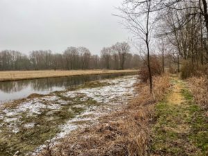
Today’s trek to Hudson Road was awesome. Where to start …
Rain and snow fell overnight, but by morning the precipitation had stopped. I met Trail Angel Nikki from the Baw Beese chapter at the Hudson Road trailhead, and she shuttled me back to Herring Road. The trail intersects with this road .3 miles (.5 km) from the Boy Scout camping site and the spur trail that I took yesterday to the parking area. I’d initially thought I’d have to start in from there, once again wading through the water past that picnic table, but then I realized I had another choice.
If Nikki dropped me off on Herring Road, I could do an out-and-back hike to the campsite, which was about the same mileage as hiking in from the parking area near Mount Hope – but without having to wade through the water. The choice was easy.
Disclosure: This post contains affiliate links (among regular links) to products I own and like, or which I think you might like. This means that, at no extra cost to you, I will earn a commission if you click through and make a purchase.
Making My Way to Hudson Road
While I’m a big planner, and have intricately detailed itineraries before I hike, once I’m on the trail I only look at one day at a time. And I often forget what I’ve looked at the night before! I was thinking today was mostly road walking, but it was a lovely mix of both  roads and trail.
The morning began with a peaceful walk along quiet backcountry roads. Most were dirt, and there were a lot of long uphills. It was cool, but not windy. Just very enjoyable.
As the lunch hour loomed, I hit the town of Jonesville. It was a little too early for lunch, which was too bad because there were all sorts of restaurants and outdoor picnic tables. Oh, well.
Homing in on Hillsdale
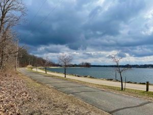
Not too long after leaving Jonesville, you come upon Hillsdale. I was on a nice recreational path through much of Jonesville, but  there’s a road walk to Hillsdale along a busy highway. The good thing is that hikers have their own blacktop path, so you’re not walking on the shoulder of a highway. And then, a big surprise.
Once I got to Hillsdale, the trail moved off the main highway and onto a lovely blacktopped path that wound through woods and alongside rivers and streams, but namely the St. Joseph River. I had my lunch here. It also eventually passed Baw Beese Lake, where this NCT chapter – Baw Beese – gets its name.
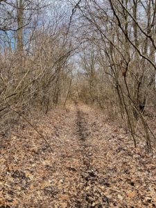
After passing the lake, the trail transitions to a dirt path that appears to be a former railway, although I can’t verify this right now, Near the end, you walk on the roads a bit before dipping back into the woods.
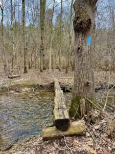
Shortly before taking the spur trail to my car at the Hudson Road parking area, you have to cross a log over a rushing stream. I’m not the greatest with balance, especially with a backpack, so I opted to scootch across sitting down. That is a lot harder than you’d think!
Snowshoe
NCT Miles Today: 19.9 (32 km)
MI NCT miles to date: 1,115.3 (1,794.9 km)
Total NCT miles to date: 1,922.5 (3,094 km)
Total NCT miles to go: 2,677.5 (4,309 km)
I have Raynaud’s Syndrome, a circulatory disorder that makes your fingers and toes extremely susceptible to cool and cold temperatures. Your digits become white, frozen and numb. So I always have hand warmers with me. There are many brands out there, and I’ve tried them all. But the best, hands down, (no pun intended) are HotHands.
Tonight I’m staying at the Holiday Inn Express in Holiday City, Ohio. It’s clean, reasonably priced and well-located to the trail. Book your stay here!

