Today’s hike was a nearly 20-miler (32.2 km) from the Cherry Valley Overlook to a spot where the trail crosses Hwy. 131 just south of Boyne Falls. Last night I fell asleep to the yips of a bunch of coyotes, which I love! In the morning, though, something was strange. My sleeping quilt was quite wet, as was a bunch of stuff in my tent. I looked up, and there were raindrops on the tent that kept falling in, despite my rain fly. What?!
I’m not sure what the issue is, so I shall have to research this when I’m back home. I think that since I was camping high on a mountain/hilltop – the Cherry Valley Overlook! – maybe a lot of overnight condensation overwhelmed my rain fly and soaked into the tent. The rain fly was completed soaked when I got out of my tent, even though it hadn’t rained and the vegetation in the vicinity was dry. So strange!
Leaving Cherry Valley
No matter. I was up and out by 8:40 a.m. I wish I could say great things about this day, but the truth is that I cannot. The first few miles were fine, through the typical “green tunnel” of hiking. I met two men hunting for grouse and woodcock, and we had a pleasant conversation. (One of the two said grouse taste so good, but he couldn’t say what the taste was like. I’d like to try grouse!)
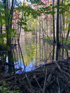
Interestingly, I hiked over SO MANY creeks that were rushing furiously. After yesterday, when I was left getting water from a barely-there creek, this was frustrating. But also funny.
Logging and Blowdowns
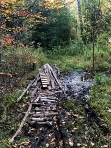
A lot of the day I passed through unsightly areas that had either been logged heavily or had had a lot of storm blowdowns. Thanks to all of the volunteers who cleared the trail for people like me! And this is not meant to be disrespectful, but sometimes the trail isn’t magically beautiful. Sometimes it’s scruffy and mean and hard and that’s O.K. It makes you stronger and is still beautiful in its own way.
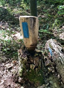
Maybe early afternoon, I hit an area where the blazes went in two different directions. One pointed to an unmaintained trail, while the other followed a very steep and sandy maintenance road. My Avanza map was no help; it showed me off the trail if I followed the vehicle track. But that was the clearest – the unmaintained trail was in very rough shape – so I went that way. And it was the correct way. (Perhaps the blazes were old?)
 But despite the road being clear, it was a hard trek that involved a lot of walking on sandy soil and rocks. But I persevered. And when I finally hit Hwy. 131 just south of Boyne Falls, I was so happy!
Disclosure: This post contains affiliate links (among regular links) to products I own and like, or which I think you might like. This means that, at no extra cost to you, I will earn a commission if you click through and make a purchase.
A Decadent Night
Tonight I’m ensconced in the lovely Boyne Mountain Lodge, where I did some laundry and enjoyed a salad at one of their restaurants. (I always crave salads when I’m hiking.) I had planned to hike one more day, to the Pinney Bridge Campground. But the forecast calls for rain all day. Normally, I never deviate from my plans. But I’m older and wiser. Why hike in the rain all day, especially when this last day was randomly set? So tomorrow I head home.
I’m sad that my exploration of the North Country Trail has come to an end for 2020, but I’m thrilled that I completed the U.P. and have started my exploration of the Lower Peninsula. Fingers crossed that I will be able to complete Michigan in 2021.
Snowshoe
MI NCT miles today: 19.6 (31.5 km)
MI NCT miles to date: 611.3 (983.8 km)
Total NCT miles to date: 1,378.8 (2,219 km)
Total NCT miles to go: 3,221.2 (5,184 km)
Book your stay at Boyne Mountain Lodge here. It’s a great spot!
I always carry Tide packets when I’m backpacking. They’re lightweight and less expensive than soap in a laundromat or motel. Get yours here!


