Today’s hike was from Old Victoria to Gardner Road. I was a tad nervous because I kept hearing different things about a giant beaver dam. Was there a detour in place? Would I be bushwhacking? What if there was no way across?
The crossing was said to be near the end of the hike, so I decided to take things one at a time. I left my car at Old Victoria and re-hiked about 3/4 of a mile (1.2 km) on the road to the starting point. The trek began down a gravel road that went down, down, down to the Victoria Dam and the river.
Lots of warning signs say that if you hear a siren, beware that the river level rises quickly and dramatically. Yikes! This is an NCT crossing, plus a portage for canoes/kayaks. I hoped they had cameras to see if someone was crossing before letting loose with the water!
Luckily, when I reached the river it was low and I could hop across on rocks. And the siren didn’t sound.
Leaving Old Victoria Behind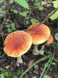
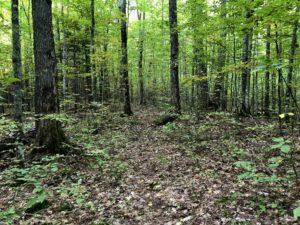
There was a big, steep climb after crossing the river. Once up on the ridge, the path tumbled long merrily. It was hummocky and sort of like hiking on moguls.
Around 1 p.m. or so I reached O-Kun-de-Kun Falls. Gotta love that name! There were several levels to the falls and they were quite lovely. I had lunch here, took lots of pix and met some nice folks.
A suspension bridge goes over the river, and then you’re on your way again. But from here, the trail got gnarly. It wound through lots of unkempt vegetation and slowed me down. Luckily, there were more than a few pops of fall color to cheer me up.
Disclosure: This post may contain affiliate links (among regular links) to products I own and like, or which I think you might like. This means that, at no extra cost to you, I will earn a commission if you click through and make a purchase.
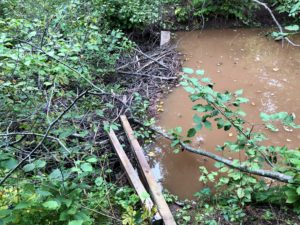
The Big Beaver Dam
A few miles from the trailhead I hit “the beaver dam.” The one everyone talked about. There was an earlier, smaller dam that was easy to cross, as people had put some boards on either end. This second one had a clearly marked detour around it. The only sad thing was that one section required walking across a log (over very deep water), and it was at that point that one of my new AirPods Pro plopped out of my ear and into the drink. As if totaling my car in a pool of water on this trail earlier this year wasn’t enough! I was so upset and sad, as I’ve come to love listening to podcasts as I hike.
After that, the trail devolved into a muddy, swampy mess. About a quarter-mile (.4 km) from the trailhead, I came upon the creek I’d hoped to camp near. Nope! It was surrounded by marshland. So I ended up pitching my tent next to the spacious parking area, which was empty.
Trail Angels!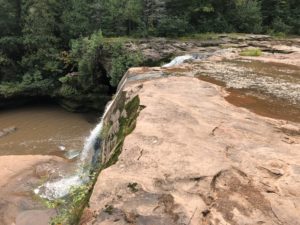
Carrie and her husband picked me up tonight and took me back to Old Victoria, where I grabbed my car and drove back to my campsite. I’d had time to pitch my tent and clean up before they arrived, so I was able to relax over a fine freeze-dried dinner that I’d brought back to life (chicken and dumplings).
I didn’t bring my Thermacell because I figured the mosquitoes would be gone by now. Nope. They were annoying all night.
Snowshoe
MI NCT miles today: 15.6 (25.1 km)
MI NCT miles to date: 460.2 (740.6 km)
Total NCT miles to date: 1,227.6 (1,975.6 km)
Total NCT miles to go: 3,372.4 (5,427.4 km)
Get your AirPods, Thermacell and backpacker meals here, where I did!


