Today’s itinerary called for hiking about six miles (10 km) south from Black River Harbor on trails, then segueing onto connecting roads and ending somewhere on Lake Road. Tom, my colleague, collected me from the Presque Isle campground about 8:30 a.m. and we were off. But we didn’t head straight to Black River Harbor.
Instead, I had him stop at the short trail segment leaving Presque Isle, where I was sure I had lost/dropped my bag holding my water filter, medical kit and other items yesterday. I was sure it had to be near this huge downed tree, where I’d stopped to take care of some abrasions. I hiked back in, but didn’t see the bag. Rats. And so strange.
Making My Way to Lake Road
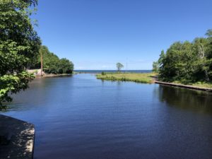
From there, Tom drove us up to Black River Harbor. Here, we hiked out on the suspension bridge where I should have come across yesterday, if that connecting road was in even mediocre shape. Then he left and I took off.
This section of the trail features several waterfalls. A few require hiking down long staircases. I skipped the first one to Rainbow Falls, because it was so long. But I checked out all of the others. They were very cool. Unfortunately, I hit all of them around noon, when the lightning is always terrible. My photos don’t do these waterfalls justice.
Around Copper Peak, the only ski flying hill outside of Europe, the trail dumps you off on the road. I had cell service here and was able to chat with Ed for a while.
Starting the Road Walk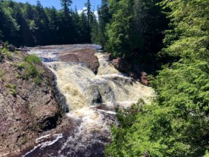
A lot of hikers hate connecting road walks, but I don’t mind them. They give my feet a break from the trails, plus they often go by pretty country scenery. I definitely saw some pretty sights today.
I’d hoped to reach the intersection of Lake Superior Road (aka Lake Road) and Maple Road before calling it a day, but a storm moved in. Tom was already in the vicinity, so I stopped a mile or so short of my goal.
En route to shuttling me back to my car on M-64, Tom took me back once again to that short section of trail where I’d lost my water filter and pack. During my hike today, I’d suddenly realized the bag probably slipped off my pack and BEHIND the log, not in front of the log where I’d checked this morning. Sure enough, I found it! That saved me about $75-$100 in supplies, so I was pretty happy.
Snowshoe
MI NCT miles today: 16 (25.8 km)
MI NCT miles to date: 394.9 (635.5 km)
Total NCT miles to date: 1,158.1 (1,863.8 km)
Total NCT miles to go: 3,441.9 (5,539.2 km)
Disclosure: This entry contains affiliate links (among regular links) to products I own and like, or which I think you might like. This means that, at no extra cost to you, I will earn a commission if you click through and make a purchase.


