Today’s goal was Metal Ford, just 15.5 miles (25 km) north. We are punting with our schedule every day, trying to make it these final miles despite our painful tendinitis.
Since Amy has plans to hike in the Grand Canyon with her husband shortly after this trip, she is doing very little hiking for the rest of this trip. No sense developing a severe case of tendinitis that will ruin her Grand Canyon adventure. My situation is different. Since my goal is to hike all 11 National Scenic Trails, I’m not stopping now, so close to the end. If it takes me a few weeks of pool-running when I get back home to calm down my tendinitis, so be it.
Thus, Amy dropped me off today solo. My goal was to hike to my car, which was dropped at the start of a paved section of the Old Trace. I had 8.5 miles (13.7 km) to hike. Could I do it?
The Plan to Get to Metal Ford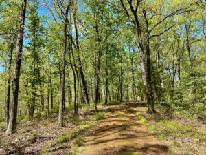
My plan was to massage my sore leg every mile, and to ice it every two hours or so. Plus take ibuprofen regularly. The first three to four hours, the plan worked OK. My leg hurt, but I could sort of ignore it.
I met Amy at the start of a drivable section of the Old Trace that runs atop a ridge. An interpretive panel explained that the parkway parallels the Trace, but doesn’t piggyback on it because that would destroy the remaining fragments. But here, we could walk or even drive along this tiny piece of the original Trace.
We did an out-and-back for 5 miles (8.1 km), and our legs felt pretty darn good. So the question becomes, why? Is it the different surface? The prescription ointment I found in my medical kit that we’ve been using? The frequent icing? Who knows.
 Day Is Done
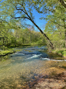
I did another 2 miles (3.2 km) on the parkway, to Metal Ford, before calling it a day. This spot is a place where the Old Trace users forded the Buffalo River. It got its name because they thought the stones on the river bottom reminded them of the stone, or “metaled,” roads back home. I hiked the small trail here, which leads past the remains of an old millrace and pig iron site.
Tonight we’re camping tonight at Meriwether Lewis, a huge park. While washing up in the restroom, I met a cyclist whose boyfriend works on the Natchez Trace National Scenic Trail (NTNST)! We exchanged info and he gave us NTNST stickers for our cars and patches for our backpacks. Too cool!
Disclosure: This post contains affiliate links (among regular links) to products I own and like, or which I think you might like. This means that, at no extra cost to you, I will earn a commission if you click through and make a purchase.
Snowshoe
Natchez Trace Miles Today: 15.5 (25 km)
NT Miles Overall: 383.8 (617.7km)
NT Miles To Go: 60.2 (96.9 km)
A good book on the Natchez Trace is Nashville to New Orleans Road Trip, a Moon guide by Meg Littman that includes info on the Trace.
I really love Dr. Teal’s scented Epsom salts, especially lavender and eucalyptus. Get yours here!
