Today was a momentous day because I’d be going through the Kettlebowl segment that all of the hiker’s I’d met had warned me about. But today was a momentous day for a few other reasons. Mainly, it marked the day I finally stopped marching east and began my dip down south to Janesville.
If you look at a map of the Ice Age Trail, there are three main segments: the march east from St. Croix Falls to Antigo, the march south to Janesville and the march back north to Sturgeon Bay. One main segment down, two to go! I’m also supposed to be heading into tamer trails, which will be much appreciated.
Kettlebowl Looms Ahead
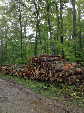
The Antigo area had rain all last night and this morning. Miraculously, as soon as I stepped out of the car at Lumbercamp, the rain stopped. Still babying my blisters, I put plastic bags over my shoes and cinched them at the ankles. I did this once before, and the bags lasted two miles (3.2 km). These puppies lasted six miles (9.7 km) – all but the final mile in Lumbercamp. Wow! The trail was perfect for a post-rainy night: mainly wide lumber roads. It was pretty easy hiking, and pretty easy to keep my feet relatively dry.
The guidebook says there’s something called the “Hillbilly Hilton” in this part of Lumbercamp. I’ve been excited to see it ever since I began planning this venture. Unfortunately, I must have passed it right by. I thought it would be easily visible, and/or have signage, but I guess not. It’s supposed to have a crude bed and table/chair, I believe, plus an iron stove.
Taking on the Kettlebowl
Next up was Kettlebowl. Now, Kettlebowl has a reputation. All of the five or so hikers I’ve met heading west said they got lost there. Joe from this chapter agreed a lot of people get lost there. He showed me loads of photos of the segment, and the different types of signage used. I vowed to rock the Kettlebowl, and be the first thru-hiker this season to successfully navigate it. I did!
But how was it? Well, trail-wise, there were a few nasty, overgrown spots (vegetation up to my waist and shoulders), but overall it wasn’t too bad. And while the trails in this area can always use a little more signage, I didn’t have any problems at all. Well, actually I had one problem.
So, the Kettlebowl segment starts off in the Kettlebowl downhill and cross country ski area. The first few miles were on wide, mowed areas that would be used for cross-country skiing in the winter. But at one point you have to turn off this wide path and take a singletrack trail into thick woods. I almost missed this turn, despite a huge sign in the woods. That’s because the narrow trail was overgrown, so I didn’t realize it was a trail at first. Anyway, the main this is that I did it!
Day Is Done!
To end the day, I ran about 10 miles (16 km) on the connecting route. We never had any more rain today, and I only changed shoes/socks three times, and that was mainly to be safe.
Thanks to Doug Erickson, my crew member extraordinaire for the weekend.
Disclosure: This entry contains affiliate links (among regular links) to products I own and like, or which I think you might like. This means that, at no extra cost to you, I will earn a commission if you click through and make a purchase.


